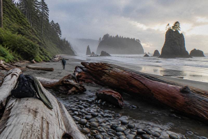
Do You Need To Visit Ruby Beach At Low Tide?
A low tide changes what Ruby Beach shows you: tide pools, wider sand and exposed sea stacks. Here is what the tides actually control, and how to plan around them.
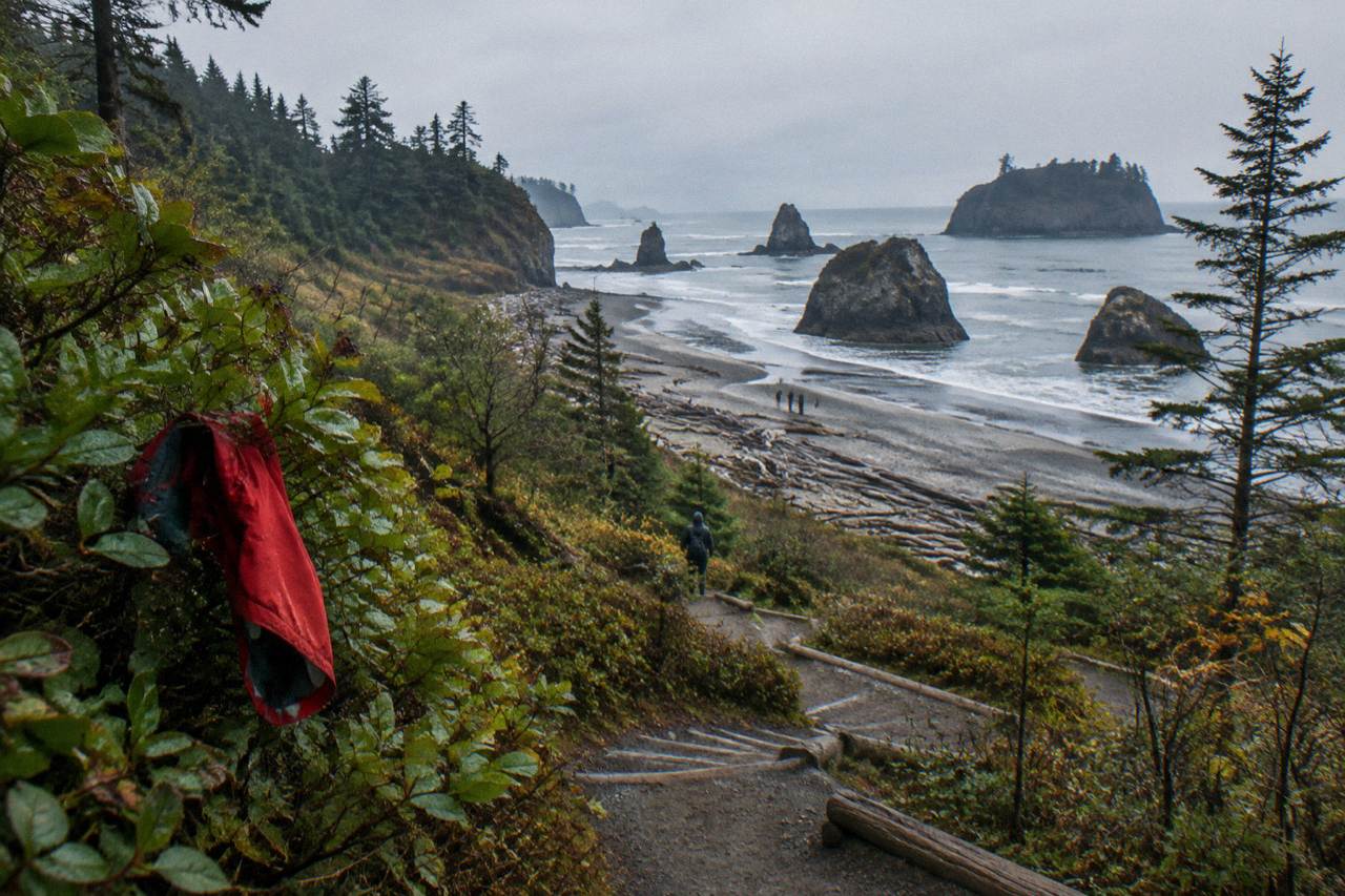
Olympic National Park holds mile after mile of wild coastline, and Ruby Beach is one of only a handful of stretches you can reach directly from Highway 101 without a long forest walk. That ease of access is exactly why the tide question comes up so often: the beach looks generous at first glance, wide sand, a creek, a wall of driftwood, sea stacks just offshore, but the water level on any given afternoon decides how much of it you can actually use. The park's own guidance on tide pools is specific: the best viewing happens at tides lower than 1 foot, what locals call a minus tide.
This page answers the low-tide question directly, then covers how to read a tide table, what the tide does and does not change, what is happening with Rialto Beach and the Mora Road closure just up the coast, and whether a guided tour beats driving yourself when your whole stop might be 45 minutes. Everything here comes from the park's published pages and the tour listings on this site.
Do You Need To Visit Ruby Beach At Low Tide?
No, you do not need low tide to have a good visit, but low tide is what unlocks the tide pools and the widest sand. Ruby Beach is enjoyable at any tide because the sea stacks, driftwood and creek are visible from the short path regardless of water level. If tide pools are the goal, the park publishes that viewing is best at tides lower than 1 foot, so plan around the tide table.
The distinction matters because many visitors treat "low tide" as a single moment, when in practice the water drops toward it, sits near it, and rises again over roughly six hours. A beach walk starting two hours before the predicted low and ending an hour after it captures the best of the exposure. Arriving at dead low and staying for three hours means you watch the pools refill and the sand shrink.
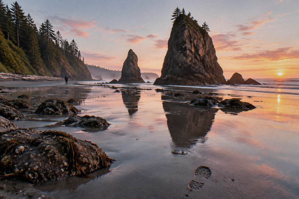
What low tide does not change: the view from the overlook at the top of the 0.25-mile path, the sea stacks themselves, the driftwood line, and Abbey Island sitting offshore. A family that arrives at a high tide in the late afternoon still gets a dramatic, photogenic beach, they simply cannot walk out among the rocks to look at anemones and sea stars.
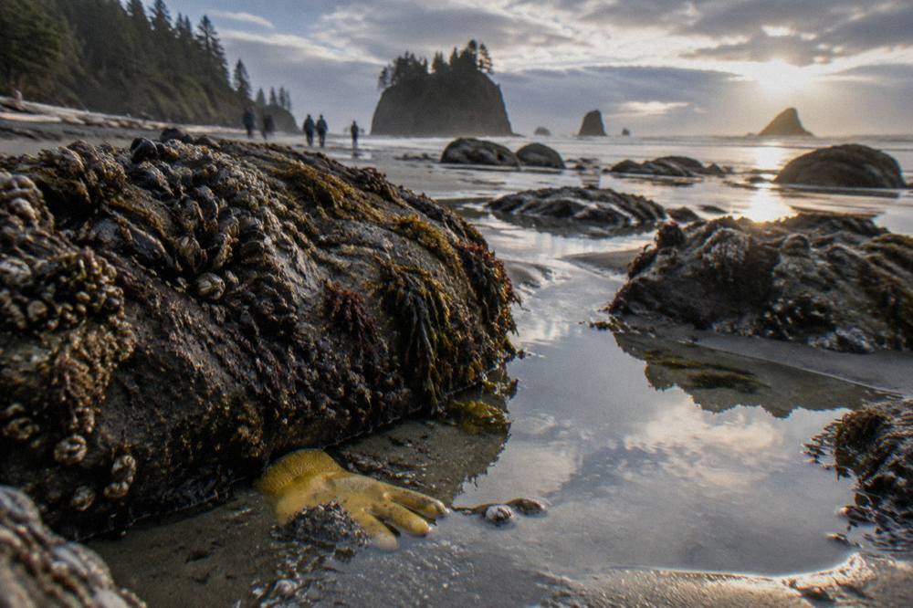
The practical rule most guides follow: if the table shows a low tide below 1 foot anywhere in your visit window, put Ruby Beach at that time. If every low in your window is 2 feet or higher, go anyway and treat it as a scenic stop, not a tide-pool stop. The park's tide pool page explains the minus-tide threshold and the safety rules that come with rocky intertidal walking.
For travelers coming from Seattle on a guided day, the tide is usually chosen for you: operators build the coast stop into a fixed schedule, so the beach stop lands where the route puts it. If a minus tide is the priority, a self-driven day or a Port Angeles or Forks departure gives more control.
What Does Low Tide Actually Change At Ruby Beach?
Low tide changes three things: it exposes the tide pools around the rocky outcrops, it widens the walkable sand between the driftwood line and the surf, and it opens safer passage at the base of the sea stacks and toward Cedar Creek's mouth. It does not change the overlook view, the driftwood, or the sea stacks' silhouette. The intertidal life, anemones, sea stars, crabs, only appears at water levels low enough to drain the rocks.
The tide pools at Ruby Beach cluster on and around the rock formations at the north end of the main beach, and around boulders that sit isolated on the sand at lower water. At a high tide of 7 or 8 feet, those same rocks are awash or fully submerged and there is nothing to inspect. At a low below 1 foot, the pools hold standing water and the animals in it. This is why the park frames tide-pool quality in feet of tide, not in time of day: an early afternoon low of negative 1 foot is a far better tide-pool window than a mid-morning low of 3 feet.
| Tide condition | Roughly what you get at Ruby Beach | What it suits best |
|---|---|---|
| High tide, roughly 7 feet and up | Wet sand to the driftwood line, rocks submerged or awash, waves reach farther up the beach | Sea stack photography, short scenic stop, storm watching from a safe distance |
| Mid tide, roughly 2 to 6 feet | Partial rock exposure, narrow but walkable sand, pools at the margins | General beach walk, creek mouth exploring at a safe distance |
| Low tide below 1 foot (a minus tide) | Exposed tide pools on the rocks, widest sand, easier passage at the base of sea stacks | Tide pooling, long beach walks, reaching the far rock groups |
One caution belongs here even at the pleasant end of the table: sneaker waves. The park's coastal pages warn that waves can run much farther up the sand than the preceding sets, and this applies at every tide. Visitors walking the wet sand at a low tide, far from the driftwood line, are the most exposed, because a single unexpected surge can reach them. Keep an eye on the surf, keep children close, and never turn your back on the water for long.
The other thing low tide buys is time. The walkable beach at Ruby Beach at mid-to-high tide is a few minutes of strolling; at a solid low, you can spend an hour and a half moving between rock groups, watching the pools, and walking north along the sand without doubling back. Groups with kids or photographers usually notice the difference most.
If reading tide tables and driving forest roads in the same day sounds like the stressful part of the trip, the Olympic rainforest and coast tours hub lists the guided options that include coastal stops, and the Ruby Beach guide on this site covers the beach itself in more depth for those planning their own route.
How Do You Read A Tide Table For Ruby Beach?
Use the Destruction Island tide table, which the park names as the reference for this stretch of coast. Find the day's two lows, note the height in feet for each, and aim to be on the beach within about two hours either side of any low predicted below 1 foot. Heights matter more than times: a 3-foot low at noon is a scenic stop, a negative low in the late afternoon is a tide-pool stop.
Tide tables list times and heights in feet relative to the chart datum, with a low water line marked as zero. A "minus tide" is any low predicted below that zero line, so the printed height carries a minus sign. Anything between zero and about 1 foot still counts as prime viewing by the park's standard. The tide at any spot runs roughly 50 minutes later each day, so a minus low on Monday at 2 p.m. will land closer to 3 p.m. by Friday, which is worth knowing when a multi-day trip puts you on the coast twice.
Printed tide tables and the physical charts at ranger stations remain the old-school option, but most visitors now pull the numbers from a tide app or a weather site using Destruction Island or La Push as the reference station. Whichever source you use, check that it is set to Pacific time and that you are looking at the lows, not the highs, since the dramatic number on a given day is usually the morning high.
A worked example of how the logic runs:
| Day's readings (example format) | Height | What it means for a Ruby Beach stop |
|---|---|---|
| High water, early morning | A high, roughly 7 to 8 feet | Morning stop would be wet sand and sea stack views only |
| Low water, early afternoon | A mid low, roughly 2 to 4 feet | Walkable beach, marginal pools on the lowest rocks |
| High water, evening | A high, roughly 7 to 8 feet | Evening visit limited to the upper beach |
In that example shape, a common one, the afternoon low in the 2-to-4-foot range is still a perfectly good beach stop, it simply is not a tide-pool stop, and the honest move is to plan the sea-stack photography for the high and the pools for another day. There is no version of this where guessing works: the difference between a minus low and a mid low on the same calendar day at the same hour is real, and the table is the only way to know which one you got.
The Long Rainforest And Beach Day from Seattle, from $275 per person and rated 4.9 across a small pool of 86 reviews, runs about 13 hours and spends a long stretch of it on rainforest and coastal stops. For a tide-driven traveler, its value is the same trade every Seattle-departure day makes: more miles covered, less control over the exact minute the van reaches the sand. Whether that trade suits you depends on whether the tide table or the driving is the part of the day you would rather not own.
Is Ruby Beach Worth Going To?
Yes, and the tide only shapes how you use it, not whether it is worth the stop. Ruby Beach sits directly off Highway 101 with a short path from the parking area to the sand, making it one of the easiest coastal experiences in Olympic National Park. Sea stacks, a driftwood-strewn upper beach and Cedar Creek give it drama at any water level, and at a low tide the tide pools add an entirely second layer.
The comparison travelers usually run is Ruby Beach against the other named beaches, and each has a real character. Ruby Beach is the most convenient from the road with the most photographic sea stacks. Beach 4, a few miles south in the Kalaloch area, is one of the two most popular tide-pool locations the park names. Rialto Beach, north near Mora, offers the Hole-in-the-Wall arch but has an access problem right now, covered below. The Ruby versus Rialto comparison on this site works through that choice in detail.
Worth-it math also depends on where you are coming from. Ruby Beach sits on the southwest coast, with the Hoh Rain Forest roughly 45 minutes north along Highway 101, per the park's published guidance. That pairing, rainforest in the morning, coast in the afternoon, is one of the classic Olympic day shapes, and it is exactly the shape the guided products on this site are built around. The Forks Small-Group Hike, from $396 per person for 6 to 8 hours out of Forks with a naturalist guide, snacks and beverages included, bring your own lunch, is one such option, with a review from Curtis_F praising a route that included "rain forest, Ruby Beach, Sitka Spruce."
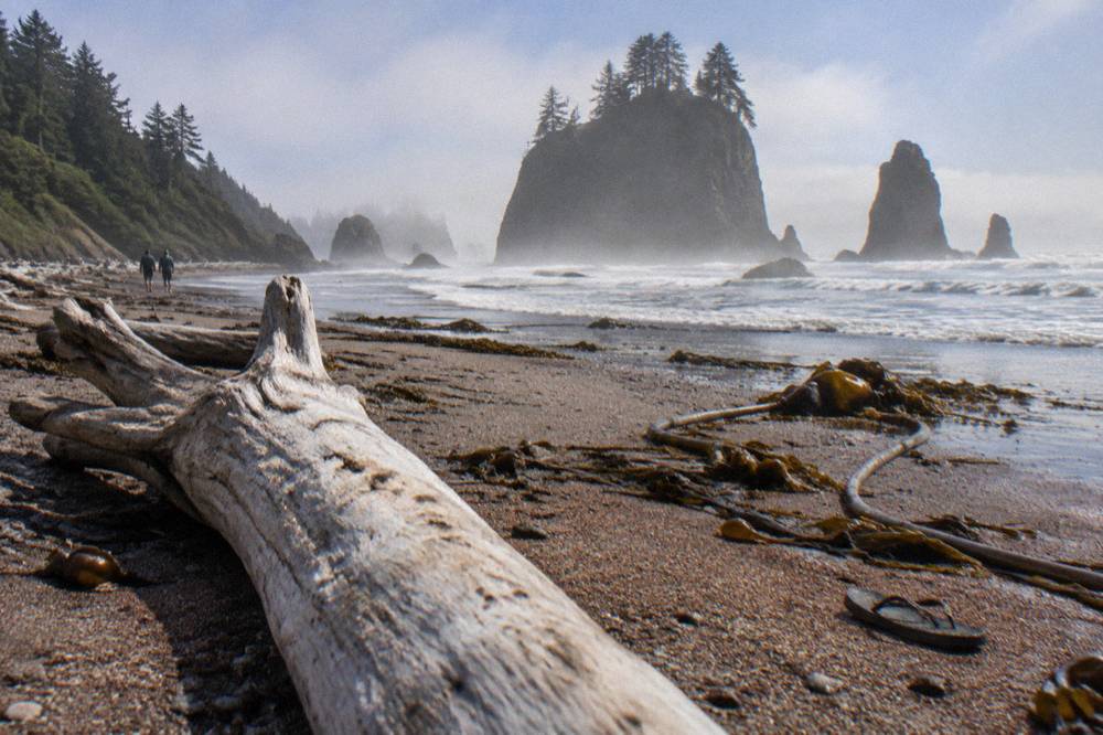
For visitors who measure a stop in minutes, the honest account is this: 20 minutes at high tide delivers the postcard view, the creek and a feel for the place, and that satisfies many people breaking a long drive. An hour at a low below 1 foot delivers a different beach entirely. Both are worth going to; they are just not the same visit. Planning around the low tide is the difference between the two, and it costs nothing except checking a table before you leave.
Can You See Tide Pools At Ruby Beach Without A Minus Tide?
You can see some, but not the good ones. At mid tides of 2 to 4 feet, the isolated boulders near the driftwood line often hold shallow pools with small crabs and anemones at their edges. The rich, concentrated tide pools the park describes sit on rock formations that only drain at lows below 1 foot, so a visit timed to anything higher leaves the best habitat underwater.
The intertidal zone at Ruby Beach is layered vertically like a ladder, and the tide decides which rungs are visible. The upper rocks, the ones the highest tides barely reach, host barnacles and hardy mussels, and those show at almost any water level. The mid zone adds sea stars and green anemones. The lowest rocks, exposed only around minus tides, carry the densest and most delicate life, and the animals there can only tolerate brief exposure, which is also why the park asks visitors not to pry creatures off rocks or step into pools. Everything else covered here is indexed on Olympic National Park Tours.
That vertical layering has a practical consequence: every foot of tide you gain adds a different band of life to look at. Dropping from a 4-foot low to a zero-foot low does not just widen the sand, it opens a whole tier of habitat that the previous visitors of the day never saw. Regulars to the coast time their trips to the biggest lows of the month, which cluster around the new and full moons, when lows routinely run below zero. A vacation week that happens to contain one of those bigger lows is worth reshuffling the coast day around.
The park's Kalaloch and Ruby Beach page names Beach 4 and Hole-in-the-Wall as the most popular tide-pool spots on this coast and repeats the under-1-foot rule. If pools are the whole point of your coastal day and the tide table will not cooperate during your trip, one honest answer is to move the goal: the Kalaloch-area beaches, a short drive south, share the same tide window and the same rules, and Beach 4 is the strongest tide-pool alternative that stays on Highway 101.
| Coastal stop | Access | Tide-pool character | Notes from the park's pages |
|---|---|---|---|
| Ruby Beach | Directly off Highway 101, short path | Pools on rocks at the north end and on isolated boulders | Sea stacks and creek at any tide; best pools below 1 foot |
| Beach 4 (Kalaloch area) | Directly off Highway 101 | One of the two most popular tide-pool locations | Same minus-tide rule applies |
| Rialto Beach / Hole-in-the-Wall | Via Mora Road, currently closed to traffic | Arch and pools about 1.5 miles north of the trailhead | Mora Road is closed at the campground for flood-damage repairs |
What About Rialto Beach And The Mora Road Closure?
Rialto Beach is not accessible by vehicle right now: Mora Road is closed to all traffic at the campground while severe winter flood damage is repaired, and that closure runs through October 15. The listing for the Hoh And Rialto tour out of Port Angeles still names Rialto Beach, so confirm the operator's current itinerary on the live listing before the trip. Ruby Beach, Kalaloch and Beach 4, all on Highway 101, remain the reliable coastal stops.
That is the plain factual state of the coast road, and it reshapes tide planning for anyone who had their heart set on Hole-in-the-Wall, the sea-carved arch about 1.5 miles north of the Rialto trailhead. The park's alerts page carries the closure, and its pages also warn that beach walking anywhere on this coast depends on the tide, since areas can become impassable, so a Rialto-area visit was never a tide-optional walk in the first place.
For tour shoppers, the closure has a direct bearing on three products in this site's roster: the Hoh And Rialto day from Port Angeles, from $195 per person and rated 5.0 across 172 reviews, its Seattle-departure counterpart, and the Rialto Tide Pooling Hike, from $315 per group for 4 to 6 hours out of Forks with poles, water filtration and a guide; lunch, snacks and gratuities are extra, and it carries no reviews yet. Each listing names Rialto, and each operator will have adapted its route while Mora Road is shut. The right move is to treat the listing description as the itinerary and ask the operator directly what the coast stop is on your date.
The rest of the coast is unaffected. Highway 101 serves Ruby Beach, the Kalaloch beaches and Beach 4 directly, and the Hoh Rain Forest, about 45 minutes north of Kalaloch, stays reachable. The bridge work on Highway 101 at the Hoh River brings its own pattern: overnight closures from 7 p.m. to 5:30 a.m. each night October 13 to 19, with no detour across the river, though the Hoh remains reachable from Forks on the north side. Daytime travel across the bridge continues outside those overnight windows, and travelers staying in Forks or coming from the north notice no change at all. Check the park's conditions page and the road and weather recording at 360-565-3131 before any coast day.
Should You Take A Tour Instead Of Driving Yourself To Ruby Beach?
Take a tour if the drive is the burden and a guide adds value, drive yourself if the tide is the priority. A Seattle day tour runs 10 to 13 hours and covers a selection of stops, so the beach stop lands where the schedule puts it, tide notwithstanding. Driving yourself means you can sit on the beach through the entire low window, but you own the ferry, the forest roads and the parking.
The touring case is real: Seattle sits a ferry ride and a long drive from this coast, and the listed day products bundle transport, park entry where the roster says so, and food. The Rainforest, Beach, and Olympic National Park Highlights tour includes snacks and drinks, with lunch on your own, almonds, pistachios and drinks. The All-Inclusive Naturalist Day Tour, from $368 per person and rated 4.9 across 1,067 reviews, brings a professional naturalist guide, which on a tide-pool beach translates into someone who can name what is in the pools. A review from Ruth_M on that tour praises a guide who "was a wealth of information about the forest."
The self-driving case is equally real, and it is the tide case. No fixed 12-hour itinerary can promise a minus tide at Ruby Beach, because the operator cannot move the ferry sailing or the rainforest stop to chase a tide that might be at 2 p.m. on Tuesday and the following morning on Wednesday. A self-driven trip can. The tour versus driving comparison on this site runs the full trade, including the hidden costs of the DIY route.
| Option | Starting price | Duration | Tide control | What the roster includes |
|---|---|---|---|---|
| Rainforest And Beach Highlights (Seattle) | From $285 per person | 12 hours 30 minutes | Schedule-driven | Snacks |
| Long Rainforest And Beach Day (Seattle) | From $275 per person | 13 hours | Schedule-driven | See listing |
| Rialto Tide Pooling Hike (Forks) | From $315 per group | 4 to 6 hours | Highest, guide picks the window | Guide |
| Self-drive from Port Angeles or Forks | Vehicle and park entry separate | Your call | Total | Park entry $30 per vehicle for 7 days |
One middle path deserves a mention: tours that depart from Forks or Port Angeles, closer to the water, give a guide both local knowledge and a shorter leash on timing. The Forks departures on this site's roster, like the tide-pooling hike above and the Forks Small-Group Hike, run half-day or three-quarter-day formats that can bend around a tide in ways a Seattle loop cannot.
What Should You Bring For A Low-Tide Visit To Ruby Beach?
Bring sturdy closed-toe shoes with grip, layers against the wind, a tide table you have already read, and binoculars if you have them. The rocks around the tide pools are slick with algae and wet sand, sneakers or sandals slide, and the coastal wind makes the beach feel 10 degrees colder than the parking lot. Water, snacks and a full phone battery round out the kit, since there is no food service at the beach itself.
Footwear is the item that actually ruins trips. The path from the Ruby Beach parking area to the sand is short, but the tide-pool rocks are carpeted in slippery algae, and the park's tide-pool guidance recommends sturdy shoes. Sport sandals with tread serve some visitors in summer, but a shoe with a real sole does the job on wet rock. Anyone planning to walk the full low-tide sand should also expect shallow stream crossings where Cedar Creek meets the surf, which is a soggy sock moment in anything but waterproof footwear.
Layers matter more than people expect. The Washington coast is breezy and often overcast even when Port Angeles or Seattle is warm, and the onshore wind carries the chill inland. A rain shell, a warm mid-layer and a hat cover most low-tide windows, which often fall in the afternoon but can land at dawn or dusk depending on the day. The packing guide for an Olympic tour on this site covers the full kit list for the park's other districts.
Beyond the kit, the behavior rules are short and worth repeating: never pry animals off the rocks, do not step in the pools themselves, watch the surf for sneaker waves, and keep children within reach near the waterline. The park asks visitors to enjoy tide pools with eyes and cameras rather than hands, and the animals in the lowest pools are the most vulnerable to handling. Nothing in that list costs a visitor a single photo.
When Is Ruby Beach Dangerous?
Ruby Beach is most dangerous when visitors ignore three things: the tide, the surf and the logs. High tides can pinch off the walkable sand and strand walkers against the cliff or driftwood, sneaker waves can surge far up the beach without warning, and the massive driftwood logs, wet and heavy, shift in the surf and have killed visitors on this coast. A dropping or low tide with eyes on the water is the safest configuration the beach offers.
The log hazard surprises people from inland. The driftwood on Olympic beaches is not firewood, it is whole trees, waterlogged and weighing tons, and a wave that lifts one end can move it fast enough to crush a person sitting behind it. The standing rule on this coast is simple: never sit or camp near logs, and never turn your back on the surf. The park's coastal pages carry this warning for every beach from Ruby to Kalaloch.
The tide hazard is the mirror of everything above. Everything this page recommends for tide pools, arriving before the low, walking far out on exposed sand, is safe only while the tide is out and while you track the water's return. Set an informal turnaround: when the sand you crossed starts narrowing, head back. Beach walkers heading north toward the next headland need to note that stretches can become impassable at higher water, the same rule the park prints for the Rialto stretch, and it applies here too.
Weather adds the final layer: this coast records 100 to 170 inches of precipitation a year across its beaches and valleys, and winter storms bring surf that closes the upper beach entirely. None of this makes Ruby Beach a dangerous place in the way a slot canyon is dangerous. It makes it a place where reading the water, the tide and the logs is the whole safety brief, and where a low-tide visit with normal caution is a calm, easy family afternoon.
Do You Need Reservations Or Permits For Ruby Beach?
No reservation, timed entry or permit is needed to visit Ruby Beach for the day. The beach sits directly off Highway 101 and the only fee involved is the park entrance, $30 per private vehicle for 7 consecutive days, or $15 per person on foot or by bicycle for ages 16 and up. Overnight stays on the coast wilderness strip do require a wilderness permit booked through Recreation.gov.
The fee detail trips people up because the trailhead is a roadside pullout, not a staffed entrance station, and the Olympic Annual Pass at $55 or an America the Beautiful pass covers the same entry. Many guided tours fold the entrance fee into the ticket where the listing says so, which is one quiet advantage of the bundled products: the Rialto Tide Pooling Hike and the Hoh And Rialto day both list Olympic National Park entrance fees among their inclusions, while others leave entry separate, so the listing's inclusions line is the place to check.
The permit question only becomes real if the low tide inspires an overnight. Olympic's coastal strip is wilderness, and walking it over multiple days, including the Rialto-to-Ozette stretches, requires the year-round wilderness permit: $8 per person per night plus a $6 reservation fee, with summer-season reservations releasing April 15 at 7 a.m. Pacific on Recreation.gov and quota areas filling fast. For a day visitor standing on Ruby Beach at low tide, none of that applies; you simply walk down the path.
Common Questions About Ruby Beach Tides
Do You Need To Visit Ruby Beach At Low Tide?
No, but low tide is what exposes the tide pools and the widest sand. The park publishes that tide-pool viewing is best at tides lower than 1 foot, so if pools are the goal, time your visit to the day's lowest tide. For scenery alone, any tide works.
Is Ruby Beach Worth Going To?
Yes. It is one of the easiest coastal stops in Olympic National Park, directly off Highway 101 with a short path to the sand, and its sea stacks, driftwood and creek deliver at any water level. A low tide simply adds the tide pools on top.
Which Tide Table Should You Use For Ruby Beach?
The park names Destruction Island tides as the reference for this stretch of coast. Use that station in any tide app or printed table, note the height in feet for each low, and aim to be on the beach within about two hours either side of any low below 1 foot.
Can You Reach Rialto Beach Instead?
Not by vehicle. Mora Road is closed to all traffic at the campground through October 15 for flood-damage repairs, so Rialto Beach and Hole-in-the-Wall are not accessible that way. Ruby Beach, Kalaloch and Beach 4, all on Highway 101, are the reliable coastal stops, and anyone booked on a Rialto-named tour should confirm the current route on the live listing.
What Does A Park Entrance To Ruby Beach Cost?
Day use needs no reservation or permit, just park entry: $30 per private vehicle for 7 consecutive days, $25 per motorcycle, or $15 per person on foot or by bicycle for ages 16 and up. An Olympic Annual Pass at $55 or a federal pass covers it.
Are The Tide Pool Rules Strict At Ruby Beach?
The rules are simple: do not pry animals off rocks, do not step in the pools, and watch the surf. The park also warns about sneaker waves and shifting driftwood logs, so keep children close and never sit near the large logs on the upper beach.